
File:Kosovo03.png
Size of this preview: 516 × 480 pixels.
| |
This is a file from the Wikimedia Commons. Information from its description page there is shown below.
Commons is a freely licensed media file repository. You can help. |
Summary
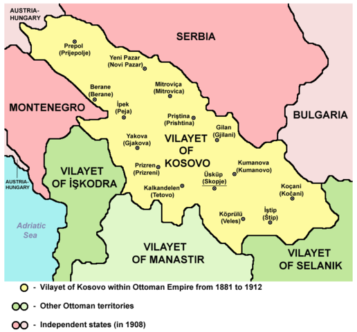
Vilayet of Kosovo within Ottoman Empire from 1881 to 1912
Source and licence
 |
This map has been uploaded by Electionworld from en.wikipedia.org to enable the |
 |
This work has been released into the public domain by its author, PANONIAN. This applies worldwide. In some countries this may not be legally possible; if so: PANONIAN grants anyone the right to use this work for any purpose, without any conditions, unless such conditions are required by law.
|
References
Main reference:
- Created according to historical map from this book: Petrit Imami, Srbi i Albanci kroz vekove, Beograd, 2000.
Secondary references with similar maps:
- Noel Malcolm, Kosovo - A Short History, Pan Books, London, 2002.
- Školski istorijski atlas, Zavod za izdavanje udžbenika SR Srbije, Beograd, 1970.
- Sve srpske mape - od šestog veka do Pariza, Specijalno izdanje BLICA, Decembar 1995. godine.
File usage
The following pages on Schools Wikipedia link to this image (list may be incomplete):
Learn more about Schools Wikipedia
SOS Children aims to make Wikipedia suitable for young learners. SOS Childrens Villages is there for the children in our care until they are ready for independence. There are many ways to help with SOS Childrens Villages.