
File:Parallel 45.jpg
- File
- File usage
- More information
Parallel_45.jpg (518 × 417 pixels, file size: 62 KB, MIME type: image/jpeg)
| |
This is a file from the Wikimedia Commons. Information from its description page there is shown below.
Commons is a freely licensed media file repository. You can help. |
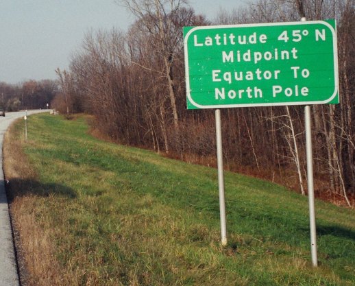
This photo is of a sign located on Interstate 89 in Vermont just south of the border with Quebec Province, Canada.
Approximative coordinates:
|
Camera location |
|
This and other images at their locations on: Google Maps - Google Earth - OpenStreetMap | ( Info) |
|---|
Licensing
 |
I, the copyright holder of this work, release this work into the public domain. This applies worldwide. In some countries this may not be legally possible; if so: I grant anyone the right to use this work for any purpose, without any conditions, unless such conditions are required by law.
|
More information
Learning is fun and easy with Schools Wikipedia. Our 500 Children's Villages provide a home for thousands of vulnerable children. Beyond our Villages, we support communities, helping local people establish better schools and delivering effective medical care to vulnerable children. There are many ways to help with SOS Children's Villages.