 |
This is a file from the Wikimedia Commons. Information from its description page there is shown below.
Commons is a freely licensed media file repository. You can help.
|
 |
This file was moved to Wikimedia Commons from en.wikipedia using a bot script. All source information is still present. It requires review. Additionally, there may be errors in any or all of the information fields; information on this file should not be considered reliable and the file should not be used until it has been reviewed and any needed corrections have been made. Once the review has been completed, this template should be removed. For details about this file, see below. Check now! |
Summary
| Description |
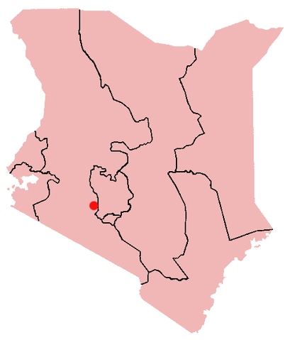
KE-Naivasha.png
English: Naivasha, Kenya Location Map; created with the GIMP. Made by User:Acntx.
|
| Date |
9 February 2006 (original upload date) |
| Source |
Own work |
| Author |
Acntx at English Wikipedia |
Licensing
Acntx at English Wikipedia, the copyright holder of this work, hereby publishes it under the following license:
 |
Permission is granted to copy, distribute and/or modify this document under the terms of the GNU Free Documentation License, Version 1.2 or any later version published by the Free Software Foundation; with no Invariant Sections, no Front-Cover Texts, and no Back-Cover Texts.
Subject to disclaimers.www.gnu.org/copyleft/fdl.htmlGFDLGNU Free Documentation Licensetruetrue
|
|
File usage
The following pages on Schools Wikipedia link to this image (list may be incomplete):
This file contains additional information, probably added from the digital camera or scanner used to create or digitize it. If the file has been modified from its original state, some details may not fully reflect the modified file.
SOS Children's Villages has brought Wikipedia to the classroom. SOS Childrens Villages is a global charity founded in 1949 to give children who have lost everything the childhood they deserve. Have you heard about child sponsorship? Visit our web site to find out.


