
File:Karoo ecoregion.jpg
Size of this preview: 623 × 480 pixels.
| |
This is a file from the Wikimedia Commons. Information from its description page there is shown below.
Commons is a freely licensed media file repository. You can help. |
Summary
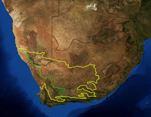
| Description | This is a map showing the location of the two Karoo ecoregions of southern Africa, as delineated by the World Wide Fund for Nature. The yellow line encloses the two ecoregions. The green line separates the Succulent Karoo, on the west, from the Nama Karoo, on the east. National boundaries are shown in black. I, Pfly, made it using NASA Blue Marble imagery and ecoregion GIS data which I simplified and digitized in Photoshop. |
| Date | 19 January 2007 |
| Source | NASA, plus my additions by myself. |
| Author | Pfly |
Licensing
 |
This file is in the public domain because it was solely created by NASA. NASA copyright policy states that "NASA material is not protected by copyright unless noted". (See Template:PD-USGov, NASA copyright policy page or JPL Image Use Policy.) |
 |
 |
Warnings:
|
File usage
The following pages on Schools Wikipedia link to this image (list may be incomplete):
Metadata
Find out about Schools Wikipedia
Wikipedia for Schools is designed to make learning fun and easy. SOS Children helps those who have nothing and no one, giving them back the famly they have lost and bringing them the very best opportunities for a happy, healthy future. Have you heard about child sponsorship? Visit our web site to find out.