 |
This is a file from the Wikimedia Commons. Information from its description page there is shown below.
Commons is a freely licensed media file repository. You can help.
|
Summary
| Description |
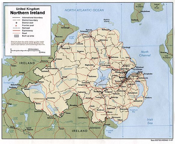
English: Map of Northern Ireland.
|
| Date |
1987 |
| Source |
Northern Ireland (U.K) (Political) 1987 from Perry-Castañeda Library Map Collection: Europe Maps |
| Author |
U.S. Central Intelligence Agency |
Permission
( Reusing this file) |
Public domain
|
 |
This image is a copy or a derivative work of northern_ireland_pol87.jpg, from the map collection of the Perry-Castañeda Library (PCL) of the University of Texas at Austin.
This tag does not indicate the copyright status of the attached work. A normal copyright tag is still required. See Commons:Licensing for more information. |
Licensing
| Public domainPublic domainfalsefalse |
 |
This image is a work of a Central Intelligence Agency employee, taken or made as part of that person's official duties. As a Work of the United States Government, this image or media is in the public domain.
|
 |
File usage
The following pages on Schools Wikipedia link to this image (list may be incomplete):
Schools Wikipedia has been carefully checked to give you the best learning experience. In 133 nations around the world, SOS Children works to bring better education and healthcare to families in desperate need of support. Why not try to learn more about child sponsorship?


