
File:Milecastle 39 on Hadrian's Wall.jpg
Size of this preview: 640 × 427 pixels.
| |
This is a file from the Wikimedia Commons. Information from its description page there is shown below.
Commons is a freely licensed media file repository. You can help. |
Summary
| Description |
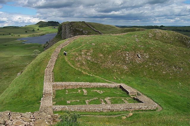
English: The remains of Milecastle 39 (coordinates 55° 0' 13.12" N, 2° 22' 32.74" W) on Hadrian's Wall; near Steel Rigg, looking east from a ridge along the Hadrian's Wall Path. Milecastle 39 is also known as Castle Nick.
Svenska: Ruinerna efter Milecastle 39 (koordinater 55° 0' 13.12" N, 2° 22' 32.74" V), beläget nära Steel Rigg utmed Hadrianus mur. Fortifikationen – som också kallas Castle Nick – vätter mot öster och är byggd på en ås längs vandringsleden Hadrian's Wall Path.
|
||
| Date | June 2007 | ||
| Source | Photograph by uploader | ||
| Author | Adam Cuerden | ||
| Permission ( Reusing this file) |
|

File usage
The following pages on Schools Wikipedia link to this image (list may be incomplete):
Metadata
Learn more
SOS Children's Villages has brought Wikipedia to the classroom. Thanks to SOS Children's Villages, 62,000 children are enjoying a happy childhood, with a healthy, prosperous future ahead of them. Help another child by taking out a sponsorship.