 |
This is a file from the Wikimedia Commons. Information from its description page there is shown below.
Commons is a freely licensed media file repository. You can help.
|
| Public domainPublic domainfalsefalse |
 |
This work has been released into the public domain by its author, SPUI. This applies worldwide.
In some countries this may not be legally possible; if so:
SPUI grants anyone the right to use this work for any purpose, without any conditions, unless such conditions are required by law.Public domainPublic domainfalsefalse
|
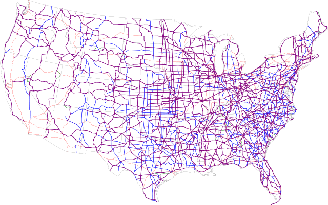
Map of the present U.S. Routes. Base map is (public domain US Federal Government).
- Purple: two-digit
- Blue: three-digit
- Green: selected alternate routes
- Red/pink: major and selected auxiliary Interstates
File usage
The following pages on Schools Wikipedia link to this image (list may be incomplete):
This file contains additional information, probably added from the digital camera or scanner used to create or digitize it. If the file has been modified from its original state, some details may not fully reflect the modified file.
SOS Children's Villages has brought Wikipedia to the classroom. SOS Children's Villages is a global charity founded in 1949 to give children who have lost everything the childhood they deserve. If you'd like to help, why not learn how to sponsor a child?


