 |
This is a file from the Wikimedia Commons. Information from its description page there is shown below.
Commons is a freely licensed media file repository. You can help.
|
Summary
| Description |
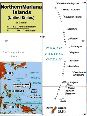
Enlarged area map of the Northern Mariana Islands. |
| Date |
6 March 2008 |
| Source |
Derived by re-labeling and narrowing map Image:Casta Marianas.jpg from maps at http://www.lib.utexas.edu/maps/ Public Domain (see http://navalhistory.flixco.info/H/118421x19817/8330/a0.htm) |
| Author |
User:Wikid77, from 2005 map of User:Bradipus |
Licensing
| Public domainPublic domainfalsefalse |
 |
I, the copyright holder of this work, release this work into the public domain. This applies worldwide.
In some countries this may not be legally possible; if so:
I grant anyone the right to use this work for any purpose, without any conditions, unless such conditions are required by law.Public domainPublic domainfalsefalse
|
File usage
The following pages on Schools Wikipedia link to this image (list may be incomplete):
SOS Childrens Villages has brought Wikipedia to the classroom. SOS Children works in 133 countries and territories across the globe, helps more than 62,000 children, and reaches over 2 million people in total. Will you help another child today?


