
File:Huanghemap.png
- File
- File usage
- More information
Size of this preview: 640 × 326 pixels.
| |
This is a file from the Wikimedia Commons. Information from its description page there is shown below.
Commons is a freely licensed media file repository. You can help. |
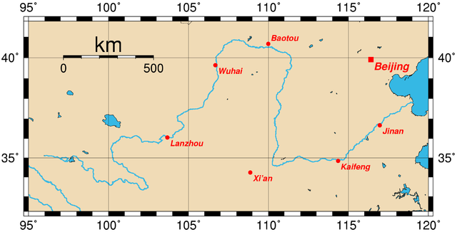
| Description | Map of the Huang He and the location of major cities along its course. This map was generated using the Generic Mapping Tools (GMT). The city coordinates (longitude, latitude) used are:
|
| Date | 14:57, 28 March 2005 |
| Source | From en wiki |
| Author | Upload by Rolfmueller |
External links
 |
Permission is granted to copy, distribute and/or modify this document under the terms of the GNU Free Documentation License, Version 1.2 or any later version published by the Free Software Foundation; with no Invariant Sections, no Front-Cover Texts, and no Back-Cover Texts. A copy of the license is included in the section entitled GNU Free Documentation License.
|
| This file is licensed under the Creative Commons Attribution-Share Alike 3.0 Unported license. | ||
|
||
| This licensing tag was added to this file as part of the GFDL licensing update.
|
More information
All five editions of Schools Wikipedia were compiled by SOS Children's Villages. SOS Childrens Villages works in 133 countries and territories across the globe, helps more than 62,000 children, and reaches over 2 million people in total. We have helped children in Africa for many years - you can help too...