 |
This is a file from the Wikimedia Commons. Information from its description page there is shown below.
Commons is a freely licensed media file repository. You can help.
|
Summary
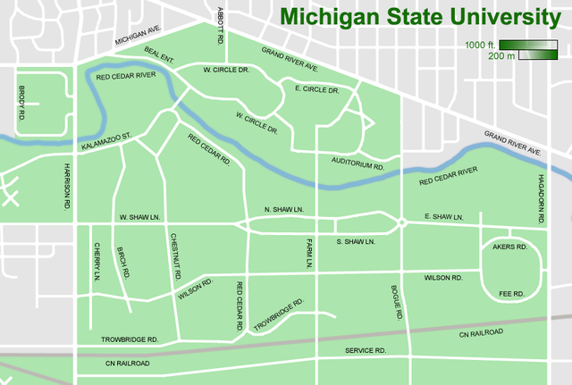
Revision of previous image, MSU_Campus_Map_small_rev2.png (2006-2007), which was a revision of MSU_Campus_Map_small.png (2005-2006). Changes from 2 to 3 are at Red Cedar & Wilson, West Circle & Auditorium, the removal of Dormitory Road, and the reconfiguration of Auditorium at Bogue (all made in Summer 2007). All revisions back to original made by Shadowlink1014.
THIS REVISION IS VALID BETWEEN AUGUST 2007 AND AUGUST 2008.
Licensing
 |
Permission is granted to copy, distribute and/or modify this document under the terms of the GNU Free Documentation License, Version 1.2 or any later version published by the Free Software Foundation; with no Invariant Sections, no Front-Cover Texts, and no Back-Cover Texts. A copy of the license is included in the section entitled GNU Free Documentation License. http://www.gnu.org/copyleft/fdl.htmlGFDLGNU Free Documentation Licensetruetrue
|
 The categories of this image should be checked. Check them now!
- Remove redundant categories and try to put this image in the most specific category/categories
- Remove this template by clicking here (or on the first line)
File usage on other wikis
Related galleries
File usage
The following pages on Schools Wikipedia link to this image (list may be incomplete):
Wikipedia for Schools was collected by SOS Children's Villages. SOS Childrens Villages is a global charity founded in 1949 to give children who have lost everything the childhood they deserve. Would you like to sponsor a child?


