
File:Scandinavia-12th century.png
Size of this preview: 406 × 480 pixels.
| |
This is a file from the Wikimedia Commons. Information from its description page there is shown below.
Commons is a freely licensed media file repository. You can help. |
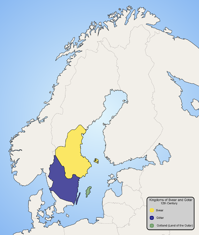
Summary
Map of Scandinavia in 12th century, showing modern borders in grey. Made by Ningyou.
Åboland connecting Åland to mainland Finland is missing from the base map and is thus colourd blue as the sea.
Licensing
 |
I, the copyright holder of this work, release this work into the public domain. This applies worldwide. In some countries this may not be legally possible; if so: I grant anyone the right to use this work for any purpose, without any conditions, unless such conditions are required by law.
|
 |
This map image could be recreated using vector graphics as an SVG file. This has several advantages; see Commons:Media for cleanup for more information. If an SVG form of this image is already available, please upload it. After uploading an SVG, replace this template with {{ vector version available|new image name.svg}}. |
File usage
The following pages on Schools Wikipedia link to this image (list may be incomplete):
I want to learn more...
Wikipedia for Schools is one of SOS Childrens Villages' many educational projects. SOS Children helps those who have nothing and no one, giving them back the famly they have lost and bringing them the very best opportunities for a happy, healthy future. Why not try to find out more about sponsoring a child?