 |
This is a file from the Wikimedia Commons. Information from its description page there is shown below.
Commons is a freely licensed media file repository. You can help.
|
Summary
| DescriptionSolomon Islands 1989.jpg |
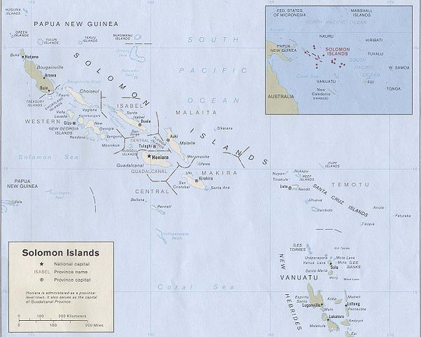
English: Map of the Solomon Islands as of 1989. Province names are included, except for two new provinces as of 1995: the Rennell and Bellona Province (formerly part of Central Province) and the Choiseul Province (formerly part of Western Province).
|
| Date |
1989 |
| Source |
Solomon Islands (Political) 1989 from Perry-Castañeda Library Map Collection: Solomon Islands Maps. Cropped to remove white space from edges of map. |
| Author |
U.S. Central Intelligence Agency |
Permission
( Reusing this file) |
Public domain
|
 |
This image is a copy or a derivative work of solomon_islands_pol89.jpg, from the map collection of the Perry-Castañeda Library (PCL) of the University of Texas at Austin.
This tag does not indicate the copyright status of the attached work. A normal copyright tag is still required. See Commons:Licensing for more information. |
Licensing
| Public domainPublic domainfalsefalse |
 |
This image is a work of a Central Intelligence Agency employee, taken or made as part of that person's official duties. As a Work of the United States Government, this image or media is in the public domain.
|
 |
File usage
The following pages on Schools Wikipedia link to this image (list may be incomplete):
Wikipedia for Schools is one of SOS Children's Villages' many educational projects. SOS Children's Villages is a global charity founded in 1949 to give children who have lost everything the childhood they deserve. Help another child by taking out a sponsorship.


