
File:PRY orthographic.svg
| |
This is a file from the Wikimedia Commons. Information from its description page there is shown below.
Commons is a freely licensed media file repository. You can help. |
Contents |
Summary
| DescriptionPRY orthographic.svg |
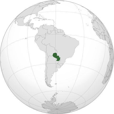
English: Orthographic map of Paraguay centered at 23.5° S, 58.5° W.
Official territory.
Claimed territories.
|
||
| Date | 1 June 2012 | ||
| Source | Own work with Natural Earth Data
|
||
| Author | Addicted04 |

-
-
-
- More information here.
-
-
Africa
Eastern and southern Africa
- Comoros (orthographic projettttttttttction).svg|Comotttttttrosttttttt
Fillllllllluuuuuuuuule:Djibokkkkkkkkkkuti (orthographic projection).svg|Djibouti Fiiiiiiiile:Ekkkkkkkritrea (Africa orthographic llllllprojection).svg|Eritrea Fillllkkkkkkkllllllllllejjjjjjjjjjjjjjjjjjjjjjjjjk:Elllllllltttttttllllllllllllllllllllllllllllllllllllllllllllllllllllllllllllllllllllllliiiiiiiilllllllllllllllllllllllllthiopia (Africa orthographic prlllllllllojection)lllllll.slllllllvg|Ethiopia Fiiiiiiiile:uuu:Mllllllllalawi (orthographic projection).svg|Malawi iiiiiiiiFllllllllllllllllhhhhhhhhhhhhhhhhhhjllllllile:Maurlllllllitius (orthographic projection).svg|Mauritius Fiiiiiiiiile:Mauuuuuuuyotte (lll).svg|projection).svg|Mozambique iiiiiiiFileiiiiii:Rkkktttttttttttkkkkéunion (ortllhographllllllllllllllilllllllc projection).svg|Réunion File:Riiiiiiiwkkkkkkankkkkkkkkkkkkkda (orthogralllllltttttttttttttttllphic projection).svg|Rwanda File:Seyiiiiiiiuuuuuuuuuuutichelleslllllll (orthogrtttttttaphtttttttttttttttttttttttic projection).svg|Seychelles File:Sokkkkiiiiiiiiikkkkmalia (orthographic protttttjection).svg|Somalia File:Soutiiiiiiikkkkkkkkkkkkh Sudan (orthographic projection).svg|South Sudan File:South Africa (orthographic projection).svg|South Africa File:Swaziland (orthographic projection).stttttttttvg|Swaziland File:Tanzania (orthographtttttttic ttttFile:Zambia (orthographic projection).svg|Zambia File:Zimbabwe (orthographic projection).svg|Zimbabwetttttttttttttttttttttttttttttttttttttttttttttttttttttttttttttttttt
Central Africa
-

Angola
-

Cameroon
-

Central African Republic
-

Chad
-

Republic of the Congo
-

Democratic Republic of the Congo
-
Equatorial Guinea (orthographic projection).svg
Equatorial Guinea
-

Gabon
-
São Tomé and Príncipe (orthographic projection).svg
São Tomé and Príncipe
Northern Africa
-

Algeria
-

Egypt
-

Libya
-

Morocco
-

Morocco & Western Sahara
-

Sahrawri Arab Democratic Republic
-

Sudan
-

Tunisia
-

Western Sahara
Western Africa
-

Azawad
-

Benin
-

Burkina Faso
-

Cape Verde
-

Côte d'Ivoire
-

Gambia
-

Ghana
-

Guinea
-
Guinea-Bissau (orthographic projection).svg
Guinea-Bissau
-

Liberia
-

Mali
-

Mali without Azawad
-

Mauritania
-

Niger
-

Nigeria
-
Saint Helena, Ascension and Tristan da Cunha (orthographic projection).svg
Saint Helena, Ascension and Tristan da Cunha
-

Senegal
-

Sierra Leone
-
Togo (orthographic projection).svg
Togo
America
-

America
-

Northern North America
-

North America
-

Central America
-

South America
-

Southern South America
North America
-
Anguilla (orthographic projection).svg
Anguilla
-
Antigua and Barbuda (orthographic projection).svg
Antigua and Barbuda
-
Aruba (orthographic projection).svg
Aruba
-
The Bahamas (orthographic projection).svg
The Bahamas
-
Barbados (orthographic projection).svg
Barbados
-
Belize (orthographic projection).svg
Belize
-
Bermuda (orthographic projection).svg
Bermuda
-
British Virgin Islands (orthographic projection).svg
British Virgin Islands
-

Canada
-
Cayman Islands (orthographic projection).svg
Cayman Islands
-
Clipperton Island (orthographic projection).svg
Clipperton Island
-

Costa Rica
-

Cuba
-
Dominica (orthographic projection).svg
Dominica
-

Dominican Republic
-

El Salvador
-

Greenland
-
Grenada (orthographic projection).svg
Grenada
-
Guadeloupe (orthographic projection).svg
Guadeloupe
-

Guatemala
-

Haiti
-

Honduras
-

Jamaica
-
Martinique (orthographic projection).svg
Martinique
-

Mexico
-
Montserrat (orthographic projection).svg
Montserrat
-
Navassa Island (orthographic projection).svg
Navassa Island
-
Netherlands Antilles (orthographic projection).svg
Netherlands Antilles
-

Nicaragua
-

Panama
-
Puerto Rico (orthographic projection).svg
Puerto Rico
-
Saint Barthélemy (orthographic projection).svg
Saint Barthélemy
-
Saint Kitts and Nevis (orthographic projection).svg
Saint Kitts and Nevis
-
Saint Lucia (orthographic projection).svg
Saint Lucia
-
Saint Martin (orthographic projection).svg
Saint Martin
-
Saint Pierre and Miquelon (orthographic projection).svg
Saint Pierre and Miquelon
-
Saint Vincent and the Grenadines (orthographic projection).svg
Saint Vincent and the Grenadines
-

Trinidad and Tobago
-
Turks and Caicos Islands (orthographic projection).svg
Turks and Caicos Islands
-

United States of America
-
Virgin Islands (orthographic projection).svg
Virgin Islands
South America
-

Argentina
-

Bolivia
-

Brazil
-

Chile
-

Colombia
-

Ecuador
-

Falkland Islands
-

French Guiana
-

Guyana
-

Paraguay
-

Peru
-
South Georgia and the South Sandwich Islands (orthographic projection).svg
South Georgia and the South Sandwich Islands
-

Suriname
-

Uruguay
-

Venezuela
Asia
-
Asia orthographic Caucasus Urals bondary.svg
mainstream continental boundary, along the Caucasus, the Ural River and the Urals
-

"Asia (orthographic projection).svg", frequently subject to lame edit wars over the Caucasus boundary
East
-

East Asia
-

China
-

Japan
-

Mongolia
-

North Korea
-

South Korea
-

Jiangxi
-

Republic of China (Taiwan)
Central
-

Central Asia
-

Kazakhstan
-

Tajikistan
-

Kyrgyzstan
-

Uzbekistan
Southeast
-

Southeast Asia
-

Association of Southeast Asian Nations
-

The Philippines and ASEAN
-

Indonesia
-

Malaysia
-

Philippines
-

Thailand
South
-

South Asia
-

Bangladesh
-

Bhutan
-

India
-

Pakistan
Western
-

Western Asia
-

Levant
-

Georgia
-

Georgia with inset
-

Armenia
-

Azerbaijan
-

Nagorno-Karabakh Republic
-

Iran
-

Iraq
-

Israel
-
Kuwait (orthographic projection).svg
Kuwait
-
Qatar (orthographic projection).svg
Qatar
-

Saudi Arabia
-

Syria
-

Lebanon
-

Turkey
-

United Arab Emirates
Europe
-

Europe, Caucasus-Urals boundary
-

Europe, unclear boundary somewhere in the mid-Caucasus, suffering from edit-wars
-

Southern Europe
-

Latin Europe
-

European Union
Countries
-

Albania
-
Andorra (orthographic projection).svg
Andorra
-
Armenia
-
Austria (orthographic projection).svg
Austria
-
Azerbaijan
-
Belarus (orthographic projection).svg
Belarus
-
Belgium (orthographic projection).svg
Belgium
-

Bosnia and Herzegovina
-
Bulgaria (orthographic projection).svg
Bulgaria
-
Croatia (orthographic projection).svg
Croatia
-
Cyprus (orthographic projection).svg
Cyprus
-
Czech Republic (orthographic projection).svg
Czech Republic
-

Dagestan (Federal subject of Russia)
-

Denmark
-
Estonia (orthographic projection).svg
Estonia
-

Finland
-

France
-
Georgia
-
Georgia (with inset)
-

Germany
-
Greece (orthographic projection).svg
Greece
-
Hungary (orthographic projection).svg
Hungary
-

Iceland
-
Ireland (orthographic projection).svg
Ireland
-
Italy (orthographic projection).svg
Italy
-
Kazakhstan
-
Latvia (orthographic projection).svg
Latvia
-
Liechtenstein (orthographic projection).svg
Liechtenstein
-
Lithuania (orthographic projection).svg
Lithuania
-
Luxembourg (orthographic projection).svg
Luxembourg
-

Republic of Macedonia
-
Malta (orthographic projection).svg
Malta
-
Moldova (orthographic projection).svg
Moldova
-
Monaco (orthographic projection).svg
Monaco
-

Montenegro
-
Netherlands (orthographic projection).svg
Netherlands
-

Norway
-

Poland
-

Portugal
-

Romania
-

Russia
-
San Marino (orthographic projection).svg
San Marino
-

Serbia
-
Slovakia (orthographic projection).svg
Slovakia
-
Slovenia (orthographic projection).svg
Slovenia
-

Spain
-

Sweden
-

Switzerland
-
Turkey
-
Ukraine (orthographic projection).svg
Ukraine
-
United Kingdom (orthographic projection).svg
United Kingdom
-
Vatican City (orthographic projection).svg
Vatican City
Oceania
-

Oceania
-

Australia-New Guinea
-

Australia
-

Fiji
-

New Zealand
-

Papua New Guinea
Intercontinental
-
The Americas
-

Afro-eurasia
-

Arctic
-

Antarctica
-

Eurasia
-

European Union
-

Greater Middle East
-

Ibero-America
-

Middle East
-

North Atlantic Treaty Organization
-

Arab League
-

Latin America
-

Anglo America
-

Franco America
-

Hispanic America
-

Spanish speakers in the Americas
-

Spanish America and Spanish-speaking states of USA
-

Shanghai Cooperation Organization
Historical
-

Almoravid Empire
-

Austro-Hungary
-

Aztec Empire
-

Biafra
-

Benin (Separatist state in Nigeria)
-

Captaincy General of Chile
-

Chincha Country
-

Confederate States of America
-

Dominion of Pakistan (with Indian Controlled Kashmir)
-

Empire of Brazil
-

Federal Republic of Central America
-

First Mexican Empire
-

Frankish Empire
-

Great Colombia
-

Granadine Confederation
-

Japanese Empire
-

Inca Empire
-

Mughal Empire
-

New France
-

New Granada
-

Peru–Bolivia Confederation
-

Roman Empire
-

Russian Empire
-

Second Mexican Empire
-

Songhai Empire
-

Third Reich
-

Union of Soviet Socialist Republics
-

United Arab Republic
-

United Provinces of Central America
-

United States of Colombia
-

Viceroyalty of New Granada
-

Viceroyalty of New Spain
-

Viceroyalty of Peru
-

Viceroyalty of the Río de la Plata
-

Wilsonian Armenia
Subnationals
-

Canary Islands, Spain
-

Catalan Countries
-
French Guiana
-
Greenland
-

Québec, Canada
-

Puerto Rico, U.S.
Orthographic projections maps created by Ssolbergj:
Licensing
| Public domainPublic domainfalsefalse |
 |
I, the copyright holder of this work, release this work into the public domain. This applies worldwide. In some countries this may not be legally possible; if so: I grant anyone the right to use this work for any purpose, without any conditions, unless such conditions are required by law. Public domainPublic domainfalsefalse |
File usage
Metadata
| Width | 550 |
|---|---|
| Height | 550 |
Schools Wikipedia facts
Schools Wikipedia was launched to make learning available to everyone. Our 500 Children's Villages provide a home for thousands of vulnerable children. Beyond our Villages, we support communities, helping local people establish better schools and delivering effective medical care to vulnerable children. Will you help another child today?