
File:Rotterdam-topografie.jpg
Size of this preview: 640 × 460 pixels.
| |
This is a file from the Wikimedia Commons. Information from its description page there is shown below.
Commons is a freely licensed media file repository. You can help. |
Summary
| Description |
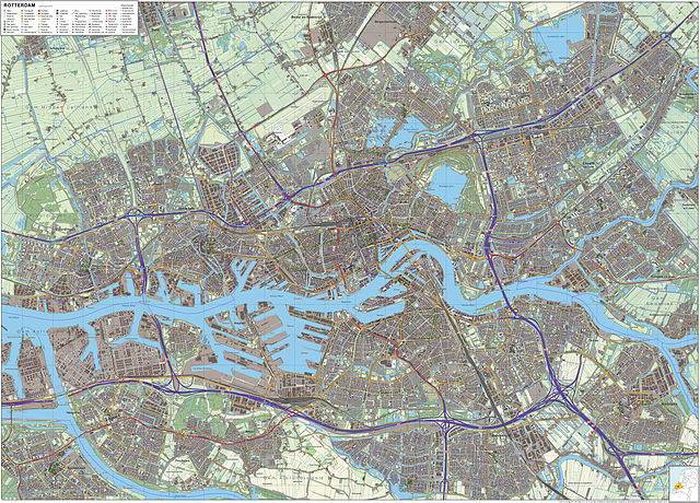
Nederlands: Topografisch beeld van Rotterdam en omgeving.
Op basis van de GML open geodata van de BRT/Top10NL (basisregistratie Topografie, Kadaster 2012), vrijgegeven door Kadaster op 30-11-2012 onder de Creative Commons BY licentie. Gebouwvlakken vanuit Open Geodata BAG extract (december 2012). Samenstelling en kleurenschema: Jan-Willem van Aalst, met QuantumGIS en Photoshop. |
| Date | 16 March 2012 |
| Source | Own work |
| Author | Janwillemvanaalst |
Licensing
|
File usage
The following pages on Schools Wikipedia link to this image (list may be incomplete):
Metadata
A background to Schools Wikipedia
Wikipedia for Schools was collected by SOS Children's Villages. By supporting vulnerable children right through to adulthood, SOS Children's Villages makes a lasting difference to the lives of thousands of people. Education is a key part of our work, and our schools provide high-quality teaching to the children in our care. We have helped children in Africa for many years - you can help too...