
File:Hyde Park London from 1833 Schmollinger map.jpg
| |
This is a file from the Wikimedia Commons. Information from its description page there is shown below.
Commons is a freely licensed media file repository. You can help. |
Summary
| Description |
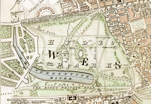
English: Hyde Park section of "Improved map of London for 1833, from Actual Survey. Engraved by W. Schmollinger, 27 Goswell Terrace", photographed for Wikipedia by User:Pointillist. All rights of the photographer are hereby released.
|
| Date | 31 March 2008 |
| Source | http://en.wikipedia.org/wiki/Image:Hyde_Park_London_from_1833_Schmollinger_map.jpg |
| Author | en:User:Pointillist |
| Permission ( Reusing this file) |
original text: {{PD-art}} |
Licensing
 |
This image (or other media file) is in the public domain because its copyright has expired. This applies to Australia, the European Union and those countries with a copyright term of life of the author plus 70 years.
|
|
|
|
File usage
Metadata
Learn more
Wikipedia for Schools brings Wikipedia into the classroom. SOS Children's Villages helps those who have nothing and no one, giving them back the famly they have lost and bringing them the very best opportunities for a happy, healthy future. Help another child by taking out a sponsorship.