
File:Lakechad map.png
| |
This is a file from the Wikimedia Commons. Information from its description page there is shown below.
Commons is a freely licensed media file repository. You can help. |
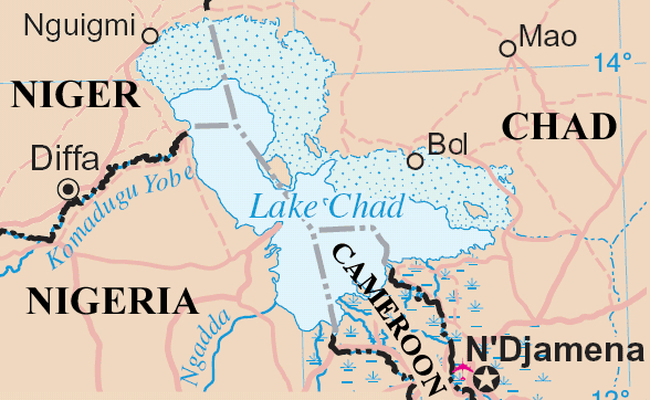
Lake Chad and surrounding area
Map adapted from http://www.un.org/Depts/Cartographic/map/profile/niger.pdf
 |
This image is a map derived from products of the United Nations Cartographic Section. Modified versions of UNCS maps may be used provided that the UN name and reference number does not appear on any modified version and a link to the original map is provided. Modified UN maps are to be considered in the public domain. This applies worldwide. The UN maps is an open source material. You can use them to make your own maps. You do not need our permission for that. Please be advised that the UN name and reference number should not appear on any modified map. The UN map is a UN document and cannot be modified. You can say something like "Based on UN map number..." -- Vladimir Bessarabov (UNCS Cartographer), 13 April 05 |
 |
File usage
Find out more
Schools Wikipedia was launched to make learning available to everyone. SOS Children's Villages helps those who have nothing and no one, giving them back the famly they have lost and bringing them the very best opportunities for a happy, healthy future. Have you thought about sponsoring a child?