
File:Nicobar Islands.jpg
Size of this preview: 547 × 480 pixels.
| |
This is a file from the Wikimedia Commons. Information from its description page there is shown below.
Commons is a freely licensed media file repository. You can help. |
Summary
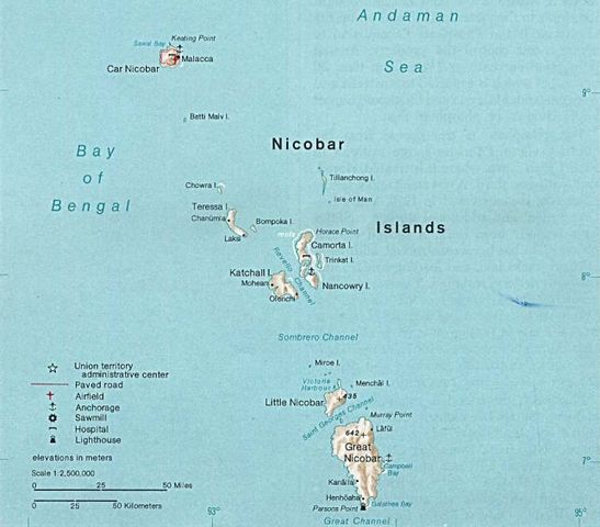
| Description | Deutsch: Karte der Inselgruppe der Nikobaren im Indischen Ozean
English: Map of the Nicobar Island in the Indian Ocean
Français : Carte d’îles Nicobar dans l’océan Indien
|
| Date | 1976 |
| Source | http://www.lib.utexas.edu/maps/islands_oceans_poles/andaman_nicobar_76.jpg |
| Author | Taken from Perry-Castañeda Library (PCL), originally from CIA Indian Ocean Atlas |
Licensing
 |
This image is a work of a Central Intelligence Agency employee, taken or made as part of that person's official duties. As a Work of the United States Government, this image or media is in the public domain.
|
 |
File usage
The following pages on Schools Wikipedia link to this image (list may be incomplete):
Find out about Schools Wikipedia
SOS Children chose the best bits of Wikipedia to help you learn. SOS Children works in 133 countries and territories across the globe, helps more than 62,000 children, and reaches over 2 million people in total. Sponsoring a child is a great way to help children who need your support.