 |
This is a file from the Wikimedia Commons. Information from its description page there is shown below.
Commons is a freely licensed media file repository. You can help.
|
Summary
| Description |
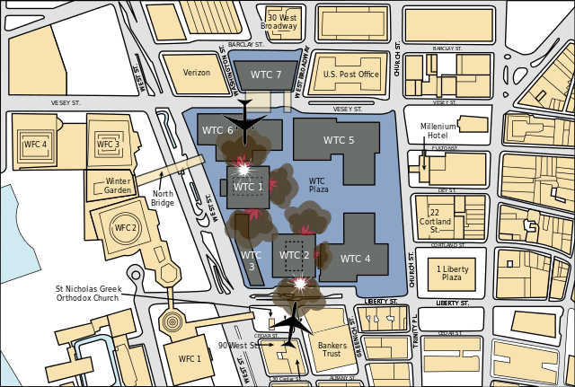
English: Illustrative guide to the relative positioning of the planes that caused the 9/11 disaster.
 ✓ The source code of this SVG is valid. ✓ The source code of this SVG is valid.
|
|
This vector graphics image was created with Adobe Illustrator. |
|
| Date |
28 October 2011 |
| Source |
FEMA (Page 5) |
| Author |
Fred the Oyster |
Licensing
| Public domainPublic domainfalsefalse |
 |
This image is a work of a Federal Emergency Management Agency employee, taken or made as part of that person's official duties. As works of the U.S. federal government, all FEMA images are in the public domain. Additional media usage information may be found at http://www.fema.gov/help/usage.shtm
česky | English | eesti | italiano | македонски | മലയാളം | Nederlands | polski | Türkçe | 中文 | 中文(简体) | +/−
|
|
File usage
The following pages on Schools Wikipedia link to this image (list may be incomplete):
This file contains additional information, probably added from the digital camera or scanner used to create or digitize it. If the file has been modified from its original state, some details may not fully reflect the modified file.
Schools Wikipedia has made the best of Wikipedia available to students. SOS Children believes that a decent childhood is essential to a happy, healthy. Our community work brings families new opportunities through education, healthcare and all manner of support. Have you heard about child sponsorship? Visit our web site to find out.


