
File:Russian Federation (orthographic projection).svg
| |
This is a file from the Wikimedia Commons. Information from its description page there is shown below.
Commons is a freely licensed media file repository. You can help. |
Contents |
Summary
Africa
-

Africa
Eastern and southern Africa
-

Burundi
-

Comoros
-

Djibouti
-

Eritrea
-

Ethiopia
-

Kenya
-

Lesotho
-

Madagascar
-

Malawi
-

Mauritius
-

Mayotte
-

Mozambique
-
Réunion (orthographic projection).svg
Réunion
-
Rwanda (orthographic projection).svg
Rwanda
-
Seychelles (orthographic projection).svg
Seychelles
-

Somalia
-

South Sudan
-

South Africa
-
Swaziland (orthographic projection).svg
Swaziland
-

Tanzania
-

Uganda
-

Zambia
-

Zimbabwe
Central Africa
-

Angola
-

Cameroon
-

Central African Republic
-

Chad
-

Republic of the Congo
-

Democratic Republic of the Congo
-
Equatorial Guinea (orthographic projection).svg
Equatorial Guinea
-

Gabon
-
São Tomé and Príncipe (orthographic projection).svg
São Tomé and Príncipe
Northern Africa
-

Algeria
-

Egypt
-

Libya
-

Morocco
-

Morocco & Western Sahara
-

Sahrawri Arab Democratic Republic
-

Sudan
-

Tunisia
-

Western Sahara
Western Africa
-

Azawad
-

Benin
-

Burkina Faso
-

Cape Verde
-

Côte d'Ivoire
-

Gambia
-

Ghana
-

Guinea
-
Guinea-Bissau (orthographic projection).svg
Guinea-Bissau
-

Liberia
-

Mali
-

Mali without Azawad
-

Mauritania
-

Niger
-

Nigeria
-
Saint Helena, Ascension and Tristan da Cunha (orthographic projection).svg
Saint Helena, Ascension and Tristan da Cunha
-

Senegal
-

Sierra Leone
-
Togo (orthographic projection).svg
Togo
America
-

America
-

Northern North America
-

North America
-

Central America
-

South America
-

Southern South America
North America
-
Anguilla (orthographic projection).svg
Anguilla
-
Antigua and Barbuda (orthographic projection).svg
Antigua and Barbuda
-
Aruba (orthographic projection).svg
Aruba
-
The Bahamas (orthographic projection).svg
The Bahamas
-
Barbados (orthographic projection).svg
Barbados
-
Belize (orthographic projection).svg
Belize
-
Bermuda (orthographic projection).svg
Bermuda
-
British Virgin Islands (orthographic projection).svg
British Virgin Islands
-

Canada
-
Cayman Islands (orthographic projection).svg
Cayman Islands
-
Clipperton Island (orthographic projection).svg
Clipperton Island
-

Costa Rica
-

Cuba
-
Dominica (orthographic projection).svg
Dominica
-

Dominican Republic
-

El Salvador
-

Greenland
-
Grenada (orthographic projection).svg
Grenada
-
Guadeloupe (orthographic projection).svg
Guadeloupe
-

Guatemala
-

Haiti
-

Honduras
-

Jamaica
-
Martinique (orthographic projection).svg
Martinique
-

Mexico
-
Montserrat (orthographic projection).svg
Montserrat
-
Navassa Island (orthographic projection).svg
Navassa Island
-
Netherlands Antilles (orthographic projection).svg
Netherlands Antilles
-

Nicaragua
-

Panama
-
Puerto Rico (orthographic projection).svg
Puerto Rico
-
Saint Barthélemy (orthographic projection).svg
Saint Barthélemy
-
Saint Kitts and Nevis (orthographic projection).svg
Saint Kitts and Nevis
-
Saint Lucia (orthographic projection).svg
Saint Lucia
-
Saint Martin (orthographic projection).svg
Saint Martin
-
Saint Pierre and Miquelon (orthographic projection).svg
Saint Pierre and Miquelon
-
Saint Vincent and the Grenadines (orthographic projection).svg
Saint Vincent and the Grenadines
-

Trinidad and Tobago
-
Turks and Caicos Islands (orthographic projection).svg
Turks and Caicos Islands
-

United States of America
-
Virgin Islands (orthographic projection).svg
Virgin Islands
South America
-

Argentina
-

Bolivia
-

Brazil
-

Chile
-

Colombia
-

Ecuador
-

Falkland Islands
-

French Guiana
-

Guyana
-

Paraguay
-

Peru
-
South Georgia and the South Sandwich Islands (orthographic projection).svg
South Georgia and the South Sandwich Islands
-

Suriname
-

Uruguay
-

Venezuela
Asia
-
Asia orthographic Caucasus Urals bondary.svg
mainstream continental boundary, along the Caucasus, the Ural River and the Urals
-

"Asia (orthographic projection).svg", frequently subject to lame edit wars over the Caucasus boundary
East
-

East Asia
-

China
-

Japan
-

Mongolia
-

North Korea
-

South Korea
-

Jiangxi
-

Republic of China (Taiwan)
Central
-

Central Asia
-

Kazakhstan
-

Tajikistan
-

Kyrgyzstan
-

Uzbekistan
Southeast
-

Southeast Asia
-

Association of Southeast Asian Nations
-

The Philippines and ASEAN
-

Indonesia
-

Malaysia
-

Philippines
-

Thailand
South
-

South Asia
-

Bangladesh
-

Bhutan
-

India
-

Pakistan
Western
-

Western Asia
-

Levant
-

Georgia
-

Georgia with inset
-

Armenia
-

Azerbaijan
-

Nagorno-Karabakh Republic
-

Iran
-

Iraq
-

Israel
-
Kuwait (orthographic projection).svg
Kuwait
-
Qatar (orthographic projection).svg
Qatar
-

Saudi Arabia
-

Syria
-

Lebanon
-

Turkey
-

United Arab Emirates
Europe
-

Europe, Caucasus-Urals boundary
-

Europe, unclear boundary somewhere in the mid-Caucasus, suffering from edit-wars
-

Southern Europe
-

Latin Europe
-

European Union
Countries
-

Albania
-
Andorra (orthographic projection).svg
Andorra
-
Armenia
-
Austria (orthographic projection).svg
Austria
-
Azerbaijan
-
Belarus (orthographic projection).svg
Belarus
-
Belgium (orthographic projection).svg
Belgium
-

Bosnia and Herzegovina
-
Bulgaria (orthographic projection).svg
Bulgaria
-
Croatia (orthographic projection).svg
Croatia
-
Cyprus (orthographic projection).svg
Cyprus
-
Czech Republic (orthographic projection).svg
Czech Republic
-

Dagestan (Federal subject of Russia)
-

Denmark
-
Estonia (orthographic projection).svg
Estonia
-

Finland
-

France
-
Georgia
-
Georgia (with inset)
-

Germany
-
Greece (orthographic projection).svg
Greece
-
Hungary (orthographic projection).svg
Hungary
-

Iceland
-
Ireland (orthographic projection).svg
Ireland
-
Italy (orthographic projection).svg
Italy
-
Kazakhstan
-
Latvia (orthographic projection).svg
Latvia
-
Liechtenstein (orthographic projection).svg
Liechtenstein
-
Lithuania (orthographic projection).svg
Lithuania
-
Luxembourg (orthographic projection).svg
Luxembourg
-

Republic of Macedonia
-
Malta (orthographic projection).svg
Malta
-
Moldova (orthographic projection).svg
Moldova
-
Monaco (orthographic projection).svg
Monaco
-

Montenegro
-
Netherlands (orthographic projection).svg
Netherlands
-

Norway
-

Poland
-

Portugal
-

Romania
-

Russia
-
San Marino (orthographic projection).svg
San Marino
-

Serbia
-
Slovakia (orthographic projection).svg
Slovakia
-
Slovenia (orthographic projection).svg
Slovenia
-

Spain
-

Sweden
-

Switzerland
-
Turkey
-
Ukraine (orthographic projection).svg
Ukraine
-
United Kingdom (orthographic projection).svg
United Kingdom
-
Vatican City (orthographic projection).svg
Vatican City
Oceania
-

Oceania
-

Australia-New Guinea
-

Australia
-

Fiji
-

New Zealand
-

Papua New Guinea
Intercontinental
-
The Americas
-

Afro-eurasia
-

Arctic
-

Antarctica
-

Eurasia
-

European Union
-

Greater Middle East
-

Ibero-America
-

Middle East
-

North Atlantic Treaty Organization
-

Arab League
-

Latin America
-

Anglo America
-

Franco America
-

Hispanic America
-

Spanish speakers in the Americas
-

Spanish America and Spanish-speaking states of USA
-

Shanghai Cooperation Organization
Historical
-

Almoravid Empire
-

Austro-Hungary
-

Aztec Empire
-

Biafra
-

Benin (Separatist state in Nigeria)
-

Captaincy General of Chile
-

Chincha Country
-

Confederate States of America
-

Dominion of Pakistan (with Indian Controlled Kashmir)
-

Empire of Brazil
-

Federal Republic of Central America
-

First Mexican Empire
-

Frankish Empire
-

Great Colombia
-

Granadine Confederation
-

Japanese Empire
-

Inca Empire
-

Mughal Empire
-

New France
-

New Granada
-

Peru–Bolivia Confederation
-

Roman Empire
-

Russian Empire
-

Second Mexican Empire
-

Songhai Empire
-

Third Reich
-

Union of Soviet Socialist Republics
-

United Arab Republic
-

United Provinces of Central America
-

United States of Colombia
-

Viceroyalty of New Granada
-

Viceroyalty of New Spain
-

Viceroyalty of Peru
-

Viceroyalty of the Río de la Plata
-

Wilsonian Armenia
Subnationals
-

Canary Islands, Spain
-

Catalan Countries
-
French Guiana
-
Greenland
-

Québec, Canada
-

Puerto Rico, U.S.
Orthographic projections maps created by Ssolbergj:
- Russia
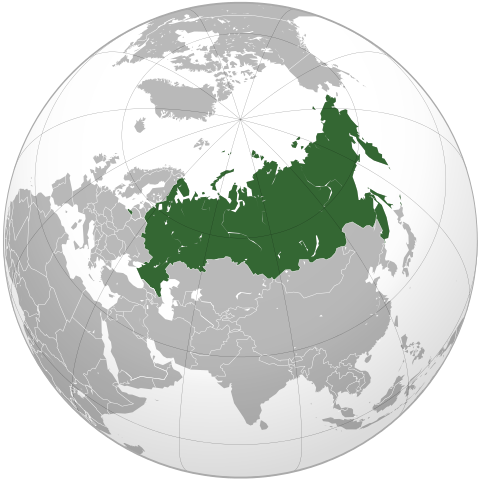
| DescriptionRussian Federation (orthographic projection).svg |
English: Russia on the globe.
Esperanto: Rusio sur la terglobo.
Русский: Россия на глобусе.
Türkçe: Rusya'nın yerküre üzerindeki konumu.
Español: Russia en el globo terráqueo.
|
||||||
| Date | 21 October 2008 | ||||||
| Source | Own work,
Aquarius.geomar.de
|
||||||
| Author | Ssolbergj |

Licensing
|
File usage
Metadata
| Width | 541.47876 |
|---|---|
| Height | 541.47876 |
About Schools Wikipedia
Wikipedia for Schools is one of SOS Childrens Villages' many educational projects. More than 2 million people benefit from the global charity work of SOS Children, and our work in 133 countries around the world is vital to ensuring a better future for vulnerable children. If you'd like to help, why not learn how to sponsor a child?