
File:Tashkent District 4 - Mirobod.png
Size of this preview: 611 × 480 pixels.
| |
This is a file from the Wikimedia Commons. Information from its description page there is shown below.
Commons is a freely licensed media file repository. You can help. |
Summary
| Description |
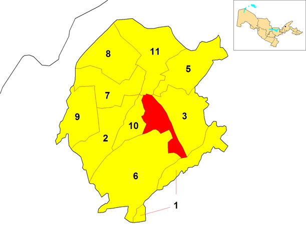
English: Locator map of Mirobod district (red) within Tashkent. A map of Uzbekistan, highlighting Tashkent (blue dot), is shown in the upper right corner
|
| Date | 23 December 2011 |
| Source | Derived from the original File:Tashkent City districts.png by Rarelibra |
| Author | Dэя-Бøяg |
| Permission ( Reusing this file) |
ok |
Licensing
|

File usage
The following pages on Schools Wikipedia link to this image (list may be incomplete):
Metadata
Wikipedia for Schools...
Wikipedia for Schools was collected by SOS Children's Villages. In 133 nations around the world, SOS Children works to bring better education and healthcare to families in desperate need of support. Try to find out how you can help children in other countries on our web site.