 |
This is a file from the Wikimedia Commons. Information from its description page there is shown below.
Commons is a freely licensed media file repository. You can help.
|
Info
| Description |
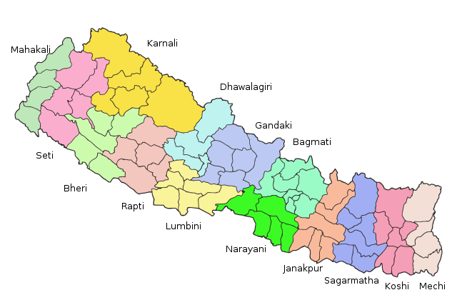
Map of the zones of Nepal. Created by Summit Raj Tuladhar, on 23 January 2007 for public domain use. Vectorised by RaviC on 19 Dec 08 |
| Date |
23 January 2007, 19 dec 08 |
| Source |
en:image:Nepal_zones.png |
| Author |
w:en:user:summitraj, w:en:user:RaviC |
Licensing
 |
The copyright holder of this work allows anyone to use it for any purpose including unrestricted redistribution, commercial use, and modification.  Please check the source to verify that this is correct. In particular, note that publication on the Internet, like publication by any other means, does not in itself imply permission to redistribute. Files without valid permission should be tagged with {{subst: npd}}. Please check the source to verify that this is correct. In particular, note that publication on the Internet, like publication by any other means, does not in itself imply permission to redistribute. Files without valid permission should be tagged with {{subst: npd}}.
Usage notes:
• If the work requires attribution, use {{ Attribution}} instead
• If this is your own work, please use {{ Cc-zero}} instead
|
| Public domainPublic domainfalsefalse |
 |
I, the copyright holder of this work, release this work into the public domain. This applies worldwide.
In some countries this may not be legally possible; if so:
I grant anyone the right to use this work for any purpose, without any conditions, unless such conditions are required by law.Public domainPublic domainfalsefalse
|
File usage
The following pages on Schools Wikipedia link to this image (list may be incomplete):
This file contains additional information, probably added from the digital camera or scanner used to create or digitize it. If the file has been modified from its original state, some details may not fully reflect the modified file.
SOS Childrens Villages chose the best bits of Wikipedia to help you learn. SOS Children's Villages is famous for the love and shelter it brings to lone children, but we also support families in the areas around our Children's Villages, helping those who need us the most. There are many ways to help with SOS Childrens Villages.


