
File:Olmec Heartland Overview 4.svg
| |
This is a file from the Wikimedia Commons. Information from its description page there is shown below.
Commons is a freely licensed media file repository. You can help. |
| |
This is a featured picture, which means that members of the community have identified it as one of the finest images on the English Wikipedia, adding significantly to its accompanying article. If you have a different image of similar quality, be sure to upload it using the proper free license tag, add it to a relevant article, and nominate it. |
|
Contents |
Summary
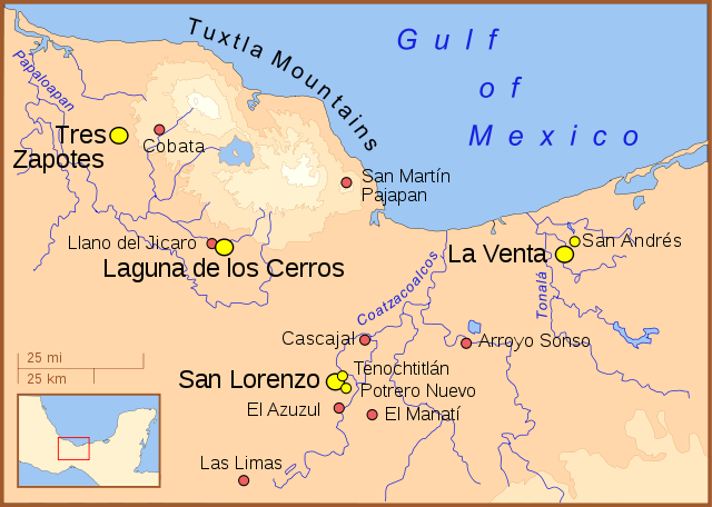
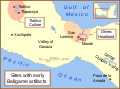
A map of the Olmec heartland. The yellow sites are known villages and towns. The smaller red dots mark locations where artifacts or art have been found unassociated with habitation. The river courses and shorelines are modern, as are the names (we don't know the names the Olmecs used).
Note: This is another version of Image:Olmec Heartland Overview v2.svg
Other versions
Part of a series:
-
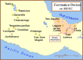
Formative Period sites in Central Mexico
-

Formative Period sites in Southeastern Mesoamerica
-
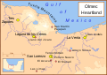
Map of the Olmec Heartland
-
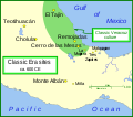
Classic era sites in Central Mexico
-
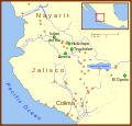
Site with early evidence for ballplaying
-
Western Mexico archaeological sites
- English version here
References
- Arnold III, Philip J. (2002) Location of Isla Agaltepec in the Tuxtla Mountains, Veracruz, Mexico., in "Isla Agaltepec: Postclassic Occupation in the Tuxtla Mountains, Veracruz, México", accessed June 2007 (for elevations).
- Coe, Michael; Snow, Dean; Benson, Elizabeth; (1986) Atlas of Ancient America; Facts on File, New York, pp. 94-95, (for the locations of the sites).
- Diehl, Richard A. (2004) The Olmecs: America's First Civilization, Thames & Hudson, London, p.12.
- Rodríguez Martínez, Ma. del Carmen;Ortíz Ceballos, Ponciano; Coe, Michael D.; Diehl, Richard A.; Houston, Stephen D.; Taube, Karl A.; Calderón, Alfredo Delgado (2006) "Oldest Writing in the New World" in Science, Vol. 313. no. 5793, pp. 1610-1614 (for location of Cascajal).
- Pool, Christopher A. (2007) Olmec Archaeology and Early Mesoamerica, Cambridge: Cambridge University Press ISBN: 978-0-521-78882-3. (for location of Cobata and Llano del Jicaro)
Licensing
|

File usage
Metadata
More information
Schools Wikipedia was created by children's charity SOS Children. Thanks to SOS Childrens Villages, 62,000 children are enjoying a happy childhood, with a healthy, prosperous future ahead of them. Would you like to sponsor a child?