
File:Bayamon Puerto Rico aerial view.jpg
Size of this preview: 640 × 447 pixels.
| |
This is a file from the Wikimedia Commons. Information from its description page there is shown below.
Commons is a freely licensed media file repository. You can help. |
| Description |
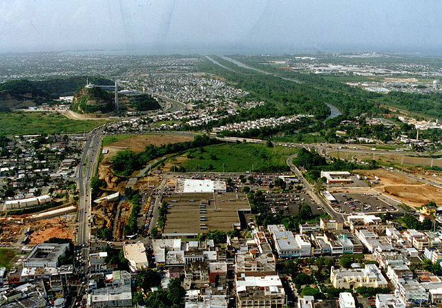
English: Aerial view of Bayamón, Puerto Rico. The U.S. Army Corps of Engineers has constructed a flood control project on the Rio de Bayamón through the city. View is to the north towards the Atlantic Ocean. The Canton Mall is visible in the centre of the picture. Coordinates: 18°24′2.41″N 66°9′26.54″W / 18.4006694°N 66.1573722°W |
|||
| Date | 1999-12-27 (Caveat: Dates provided by U.S. Army Corps of Engineers Digital Visual Library are not reliable and are often wrong.) | |||
| Source | U.S. Army Corps of Engineers Digital Visual Library Image page Image description page Digital Visual Library home page |
|||
| Author | Tony Santana, U.S. Army Corps of Engineers | |||
| Permission ( Reusing this file) |
|

File usage
The following pages on Schools Wikipedia link to this image (list may be incomplete):
Learn more about Schools Wikipedia
SOS Childrens Villages chose the best bits of Wikipedia to help you learn. SOS Children's Villages is an international children's charity, providing a good home and loving family to thousands of children who have lost their parents. We also work with communities to help vulnerable families stay together and raise children in the best possible environment. If you'd like to help, why not learn how to sponsor a child?