
File:Awashrivermap.png
Size of this preview: 480 × 479 pixels.
| |
This is a file from the Wikimedia Commons. Information from its description page there is shown below.
Commons is a freely licensed media file repository. You can help. |
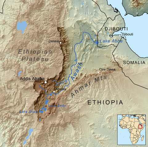
Summary
| Description | Map showing the Awash River drainage basin. |
| Date | 6 August 2010 |
| Source | Own work, Elevation data from SRTM, drainage basin from GTOPO , all other features from Vector Map. Rand McNally "New International Atlas" (1993) used as reference. |
| Author | Kmusser |
Licensing
|
File usage
The following pages on Schools Wikipedia link to this image (list may be incomplete):
Background information
Schools Wikipedia was launched to make learning available to everyone. SOS Children believes education is an important part of a child's life. That's why we ensure they receive nursery care as well as high-quality primary and secondary education. When they leave school, we support the children in our care as they progress to vocational training or higher education. Why not try to find out more about sponsoring a child?