
File:Netherlands, Zoetermeer, Zoetermeerse Meerpolder (1).JPG
Size of this preview: 640 × 425 pixels.
| |
This is a file from the Wikimedia Commons. Information from its description page there is shown below.
Commons is a freely licensed media file repository. You can help. |
Summary
| Description |
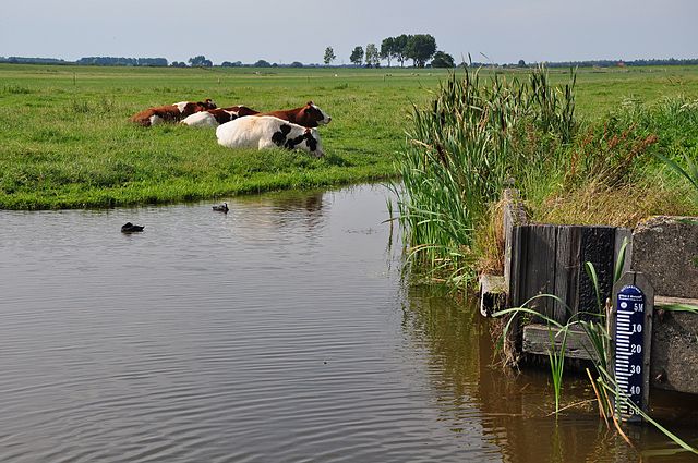
Nederlands: Een peilschaal in de Zoetermeerse Meerpolder, die aangeeft dat het waterniveau hier 5,53 m beneden Normaal Amsterdams Peil ligt.
English: A scale measuring the water level in a polder near Zoetermeer, Netherlands. The level is 5.53 meters below "Normaal Amsterdams Peil" which can be translated as Normal Height Datum of Amsterdam. This equals more or less (but not exactly) 5.53 meters below sea level; more than 18 feet.
|
| Date | 20 July 2010 |
| Source | Own work |
| Author | Vincent van Zeijst |
|
Camera location |
|
View this and other nearby images on: Google Maps - Google Earth - OpenStreetMap | ( Info) |
|---|
Licensing
|
File usage
The following pages on Schools Wikipedia link to this image (list may be incomplete):
Metadata
Find out about Schools Wikipedia
Wikipedia for Schools was collected by SOS Children. SOS Children's Villages is a global charity founded in 1949 to give children who have lost everything the childhood they deserve. If you'd like to help, why not learn how to sponsor a child?