
File:NR sheep.jpg
NR_sheep.jpg (640 × 480 pixels, file size: 173 KB, MIME type: image/jpeg)
| |
This is a file from the Wikimedia Commons. Information from its description page there is shown below.
Commons is a freely licensed media file repository. You can help. |
|
Camera location |
|
This and other images at their locations on: Google Maps - Google Earth - OpenStreetMap | ( Info) |
|---|
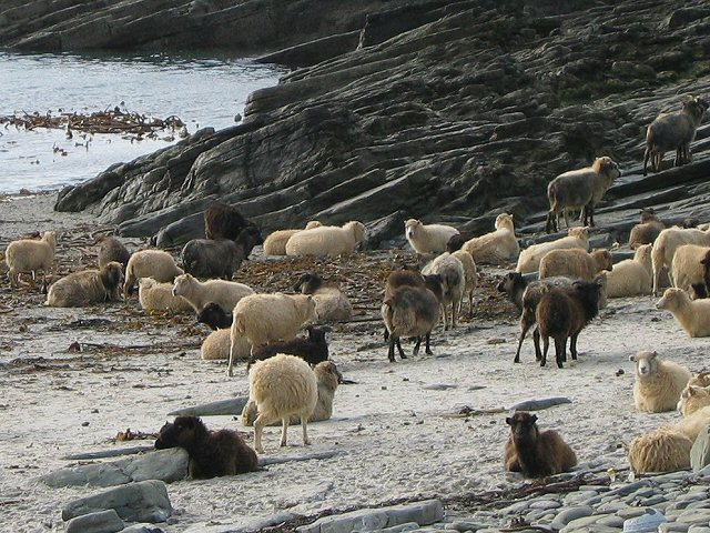
| Description | North Ronaldsay sheep. The sheep are a special breed which has evolved to eat seaweed. All access to the shore is fenced to stop them getting onto pastures as their digestive systems cannot cope with grass. | |||||||
| Date | 2 October 2003 | |||||||
| Source | The Geograph Project | |||||||
| Author | Liz Burke | |||||||
| Permission ( Reusing this file) |
|

File usage
The following pages on Schools Wikipedia link to this image (list may be incomplete):
Metadata
More information
Wikipedia for Schools is one of SOS Childrens Villages' many educational projects. SOS Childrens Villages helps more than 2 million people across 133 countries around the world. Sponsoring a child is the coolest way to help.