
File:Drury lane inset map.png
Drury_lane_inset_map.png (613 × 372 pixels, file size: 377 KB, MIME type: image/png)
| |
This is a file from the Wikimedia Commons. Information from its description page there is shown below.
Commons is a freely licensed media file repository. You can help. |
Summary
Moved from English Wikipedia:
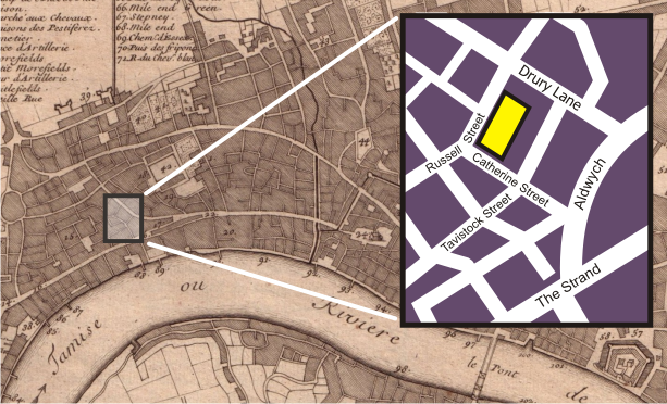
The background of this image is a section of the Public Domain http://commons.wikimedia.org/wiki/Image:Nicolas_de_fer_1700_london.jpg , a 1700 map of London. The inset map, showing the blocks around the Theatre Royal, Drury Lane in 2006, was drawn by myself, Bunchofgrapes, in Corel Draw.
Licensing
 |
Permission is granted to copy, distribute and/or modify this document under the terms of the GNU Free Documentation License, Version 1.2 or any later version published by the Free Software Foundation; with no Invariant Sections, no Front-Cover Texts, and no Back-Cover Texts. A copy of the license is included in the section entitled GNU Free Documentation License.
|
| This file is licensed under the Creative Commons Attribution-Share Alike 3.0 Unported license. | ||
|
||
| This licensing tag was added to this file as part of the GFDL licensing update.
|
File usage
The following pages on Schools Wikipedia link to this image (list may be incomplete):
I want to learn more...
Schools Wikipedia was created by children's charity SOS Children's Villages. More than 2 million people benefit from the global charity work of SOS Childrens Villages, and our work in 133 countries around the world is vital to ensuring a better future for vulnerable children. Help another child by taking out a sponsorship.