
File:NapoleonicWars.png
| |
This is a file from the Wikimedia Commons. Information from its description page there is shown below.
Commons is a freely licensed media file repository. You can help. |
Summary
| Description |
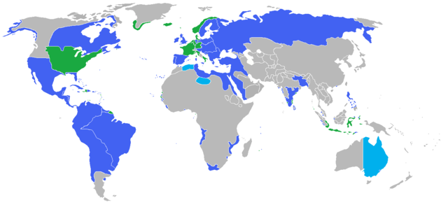
English: Locator map of the competing sides of the Napoleonic Wars before outset of the war (early 1800s).
Blue: Great Britain, Prussia, Austria, Russia, Portugal, Spain, Sweden, Ottoman Empire with more. Green: France, French client states in Europe, Denmark-Norway, USA (only at war with Britain) with more. Light blue: New South Wales, British claimed territory; Fezzan, Ottoman vassal; and the eastern "Barbary States" of Algiers, Tunis, and Tripoli nominally Ottoman governed. |
| Date | 8 June 2009 |
| Source | Own work |
| Author | Gabagool |
Licensing
|
File usage
Metadata
Schools Wikipedia and SOS Children
Wikipedia for Schools was collected by SOS Childrens Villages. SOS Children is an international children's charity, providing a good home and loving family to thousands of children who have lost their parents. We also work with communities to help vulnerable families stay together and raise children in the best possible environment. There are many ways to help with SOS Children's Villages.