
File:Frontiers of France (1521).jpg
Size of this preview: 368 × 479 pixels.
| |
This is a file from the Wikimedia Commons. Information from its description page there is shown below.
Commons is a freely licensed media file repository. You can help. |
Summary
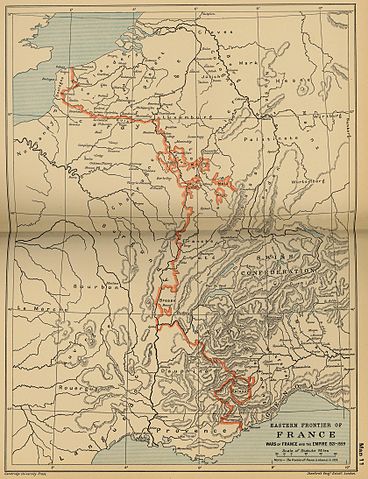
| Description | Eastern frontiers of France for the period 1521–59; line shown is the 1559 border.
|
| Date | 1912 |
| Source | The Cambridge Modern History Atlas (1912) via the Perry-Castañeda Library Map Collection at the University of Texas. |
| Author | Sir Adolphus William Ward, G.W. Prothero, Sir Stanley Mordaunt Leathes, and E.A. Benians (eds.) |
| Permission ( Reusing this file) |
Public domain as a work first published prior to 1921. |
Licensing
 |
This media file is in the public domain in the United States. This applies to U.S. works where the copyright has expired, often because its first publication occurred prior to January 1, 1923. See this page for further explanation. |
|
|
|
This image might not be in the public domain outside of the United States; this especially applies in the countries and areas that do not apply the rule of the shorter term for US works, such as Canada, Mainland China (not Hong Kong or Macao), Germany, Mexico, and Switzerland. The creator and year of publication are essential information and must be provided. See Wikipedia:Public domain and Wikipedia:Copyrights for more details. |
File usage
The following pages on Schools Wikipedia link to this image (list may be incomplete):
Metadata
Find out more
SOS Children's Villages chose the best bits of Wikipedia to help you learn. In 133 nations around the world, SOS Childrens Villages works to bring better education and healthcare to families in desperate need of support. Why not try to find out more about sponsoring a child?