
File:Zhenghe-sailing-chart.gif
Size of this preview: 640 × 456 pixels.
| |
This is a file from the Wikimedia Commons. Information from its description page there is shown below.
Commons is a freely licensed media file repository. You can help. |
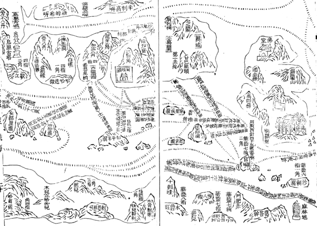
| Description | English: Part of the Wu bei zhi chart of Zheng He showing the west coast of India along the top, Ceylon top right and Africa along the bottom. The sailing directions are shown using zhen lu compass directions.
Русский: Фрагмент навигационной карты ("карта Мао Куня") из энциклопедии "Убэй чжи", показывающий бассейн Аравийского моря. Север слева, восток вверху. В правом верхнем углу - остров Цейлон (錫蘭山,Силаньшань - остров/гора Силань); в правом нижнем углу - порт Малинди (麻林地, Малиньди)
|
| Date | Early 15th century map. Published in Wubei Zhi in 1628. |
| Source | Wubei Zhi |
| Author |
Licensing
 |
This work is in the public domain in the United States, and those countries with a copyright term of life of the author plus 100 years or less. |
|
|
|
File usage
The following pages on Schools Wikipedia link to this image (list may be incomplete):
Find out about Schools Wikipedia
Schools Wikipedia was created by children's charity SOS Children's Villages. SOS Children is an international children's charity, providing a good home and loving family to thousands of children who have lost their parents. We also work with communities to help vulnerable families stay together and raise children in the best possible environment. There are many ways to help with SOS Childrens Villages.