
File:Europe map Napoleon 1811.svg
| |
This is a file from the Wikimedia Commons. Information from its description page there is shown below.
Commons is a freely licensed media file repository. You can help. |
 |
The accuracy of this map is disputed for the following reason(s): The West coast of Ireland (a straight line!?) is ridiculous. This is Ireland: File:Ireland_(MODIS).jpg |
|
The accuracy of this map is disputed for the following reason(s): The Duchy of Warsaw must be re-drawn to an accurate shape according to File:Duchy of Warsaw and Republic of Danzig.JPG |
Summary
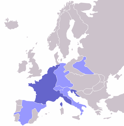
| Description | Map of the w:First French Empire and satellite states, with w:1811 borders. Created by User:OwenBlacker from Image:Europe blank map.png, therefore they are the source. |
| Date | 2009-05-03 00:13 (UTC) |
| Source |
|
| Author |
|
License
 |
I, the copyright holder of this work, release this work into the public domain. This applies worldwide. In some countries this may not be legally possible; if so: I grant anyone the right to use this work for any purpose, without any conditions, unless such conditions are required by law.
|
File usage
The following pages on Schools Wikipedia link to this image (list may be incomplete):
Metadata
More information
This selection has made Wikipedia available to all children. In 133 nations around the world, SOS Children's Villages works to bring better education and healthcare to families in desperate need of support. Would you like to sponsor a child?