 |
This is a file from the Wikimedia Commons. Information from its description page there is shown below.
Commons is a freely licensed media file repository. You can help.
|
 |
This map image could be recreated using vector graphics as an SVG file. This has several advantages; see Commons:Media for cleanup for more information. If an SVG form of this image is already available, please upload it. After uploading an SVG, replace this template with {{ vector version available|new image name.svg}}. |
Summary
| Description |
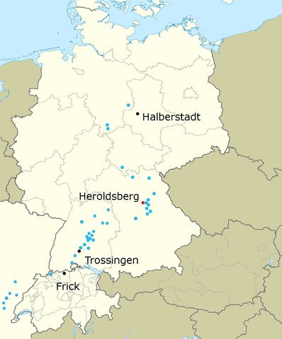
English: Map of important Plateosaurus localities. Red = likely type locality Heroldsberg, black = important sites with many and well-preserved specimens. Other localities in blue.
|
| Date |
8 May 2011 |
| Source |
Own work |
| Author |
Casliber |
Licensing
I, the copyright holder of this work, hereby publish it under the following license:
  |
This file is made available under the Creative Commons CC0 1.0 Universal Public Domain Dedication. |
| The person who associated a work with this deed has dedicated the work to the public domain by waiving all of his or her rights to the work worldwide under copyright law, including all related and neighboring rights, to the extent allowed by law. You can copy, modify, distribute and perform the work, even for commercial purposes, all without asking permission. http://creativecommons.org/publicdomain/zero/1.0/deed.enCC0Creative Commons Zero, Public Domain Dedicationfalsefalse
|
|
File usage
The following pages on Schools Wikipedia link to this image (list may be incomplete):
Schools Wikipedia was launched to make learning available to everyone. SOS Children's Villages is there for the children in our care until they are ready for independence. We have helped children in Africa for many years - you can help too...


