
File:Start of Zion Narrows trail.jpg
Size of this preview: 640 × 428 pixels.
| |
This is a file from the Wikimedia Commons. Information from its description page there is shown below.
Commons is a freely licensed media file repository. You can help. |
Summary
| Description |
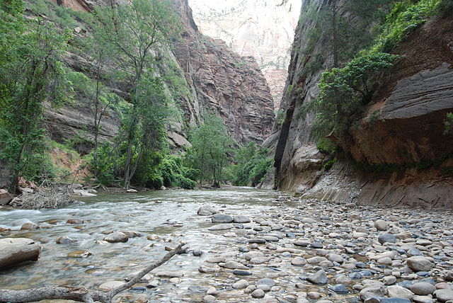
English: The starting point of the Zion narrows trail - a view from the end of the Riverside walk trail.
|
| Date | 1 July 2008 |
| Source | Own work |
| Author | Kenneth Stephen |
|
Camera location |
|
This and other images at their locations on: Google Maps - Google Earth - OpenStreetMap | ( Info) |
|---|
Licensing
|

File usage
The following pages on Schools Wikipedia link to this image (list may be incomplete):
Metadata
The best way to learn
SOS Children's Villages chose the best bits of Wikipedia to help you learn. SOS Children's Villages believes that a decent childhood is essential to a happy, healthy. Our community work brings families new opportunities through education, healthcare and all manner of support. There are many ways to help with SOS Children's Villages.