 |
This is a file from the Wikimedia Commons. Information from its description page there is shown below.
Commons is a freely licensed media file repository. You can help.
|
| Public domainPublic domainfalsefalse |
 |
This work is in the public domain in the United States because it is a work prepared by an officer or employee of the United States Government as part of that person’s official duties under the terms of Title 17, Chapter 1, Section 105 of the US Code. See Copyright. Note: This only applies to original works of the Federal Government and not to the work of any individual U.S. state, territory, commonwealth, county, municipality, or any other subdivision. This template also does not apply to postage stamp designs published by the United States Postal Service since 1978. (See 206.02(b) of Compendium II: Copyright Office Practices). It also does not apply to certain US coins; see The US Mint Terms of Use.
|
|
|
This file has been identified as being free of known restrictions under copyright law, including all related and neighboring rights.
|
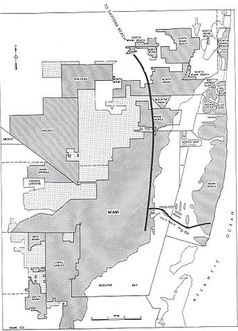
City map from the 1955 "Yellow Book" of Interstate Highway System plans, from .
- Interstates in today's terms
File usage
The following pages on Schools Wikipedia link to this image (list may be incomplete):
Schools Wikipedia was launched to make learning available to everyone. By supporting vulnerable children right through to adulthood, SOS Childrens Villages makes a lasting difference to the lives of thousands of people. Education is a key part of our work, and our schools provide high-quality teaching to the children in our care. Would you like to sponsor a child?


