
File:Weston-super-Mare tidal range.jpg
Size of this preview: 384 × 479 pixels.
| |
This is a file from the Wikimedia Commons. Information from its description page there is shown below.
Commons is a freely licensed media file repository. You can help. |
Summary
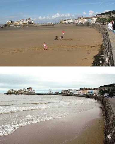
| Description | A composite photograph showing the view at the north end of Weston Bay to show the tidal range in the Bristol Channel. The upper image shows low tide, the lower image a neap high tide. |
| Date | 29 July 2007 & 4 August 2007 |
| Source | Own work |
| Author | Geof Sheppard |
|
Camera location |
|
This and other images at their locations on: Google Maps - Google Earth - OpenStreetMap | ( Info) |
|---|
Licensing
|

File usage
The following pages on Schools Wikipedia link to this image (list may be incomplete):
Schools Wikipedia and SOS Children
Through Schools Wikipedia, SOS Children has brought learning to children around the world. SOS Childrens Villages is a global charity founded in 1949 to give children who have lost everything the childhood they deserve. Why not try to learn more about child sponsorship?